
01 / THE SOURCE
Gormania & Fairfax Stone
We are a founder-led web studio based in Gormania, where the Allegheny Highlands make the North Branch feel close to home.
Meet the studioPOTOMAC LAB / RIVER STUDY 01
A website journey inspired by a real river and a real place. Our studio begins near Gormania, West Virginia, not far from the North Branch headwaters at Fairfax Stone. From here, the Potomac connects communities all the way to the Chesapeake Bay.
A SMALL, HONEST FIRST SLICE
This illustration is schematic, not a geographically accurate river map. Its curves communicate the narrative; actual mapped reach coordinates must be verified against a USGS source release before they replace the concept.
Visual stage 0: geometry is illustrative. The Rust graph core tests upstream/downstream connections using deliberately synthetic data. Source-verified geographic linework is the next data acceptance gate.
USGS DATA / SOURCE EXCERPTS
On October 27, 2026, we downloaded a small sample of actual USGS 3DHP flowlines. Three individual geometry excerpts are shown below: two labeled North Branch Potomac River and one labeled South Branch Potomac River. Each panel uses its own local scale and does not show where the fragments connect.
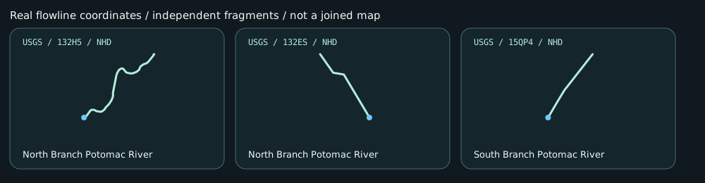
The directed Rust network will use a separately reviewed set of connected features. Until that audit is complete, the larger illustration above remains a conceptual storyboard.
THREE CHAPTERS / ONE ORIGIN STORY
01 / THE SOURCE
We are a founder-led web studio based in Gormania, where the Allegheny Highlands make the North Branch feel close to home.
Meet the studio02 / THE NORTH BRANCH
As water gathers and communities connect downstream, our work stays focused on clear, accessible websites with lasting value.
What we build03 / WHERE WATERS MEET
Separate paths can become one stronger current. Our future cinematic site will tell that story using verified river geometry and meaningful project evidence.
Explore projectsTHE ENGINEERING
We are researching USGS 3D Hydrography data and a Rust graph processor to ensure tributaries join correctly. The journey will always work as a readable website first. The cinematic experience is an optional layer, not a barrier to understanding who we are or contacting us.